4 Lesson 4
Welcome to the
Selecting Species and
Performing Habitat Assessment Lesson
In this lesson, you will:
- Identify methods for selecting species as targets for conservation plans
- Relate characteristics of selected targets, or surrogate species to habitat needs
- Learn tools for translating habitat needs to landscape spatial analysis (habitat assessment)
- Employ ModelBuilder in ArcGIS to document and repeat multiple geoprocessing steps
Lesson Topics
This lesson will cover three topics and take approximately 50 minutes to complete. We recommend working through each topic in the order in which they are listed below.
Selecting Target Species
Species-based Conservation Approach
When deciding what, where, and how to conserve, conservation practitioners must look for avenues to more readily identify and implement ways to practice on-the-ground conservation that are ecologically relevant, politically feasible, ethical, and able to be implemented economically. Usually it is best to consider the whole landscape ecosystem in conservation strategies. Yet there are many cases and reasons why conservation projects may focus on selected plant or wildlife species.
Species-based conservation approaches use target species (also called surrogate or focal species) “to represent other species or aspects of the environment to attain a conservation objective” (Caro 2010). For example, by identifying a group of species we can map key habitat locations to be protected through designation, purchase, or conservation easement. In theory, focusing conservation activities on a small set of species will provide adequate protection for a much larger set of species or aspects of the environment. As we will see though, the use of target species in conservation planning is often more complicated in practice.
Common Selection Approaches
The best approach for choosing target species depends on the conservation objectives. Carefully chosen target species can inform practitioners about where conservation efforts should be focused, and what should be done to achieve conservation objectives. Typically, target species for conservation have been selected because they are one or more of the following:
- Vulnerable Species: species that are lkely to suffer signification population declines and possible extinction across all, or significant portions, of their natural ranges without conservation intervention.
- Endemic Species: species that are found within an area, irrespective of its size, and nowhere else.
- Flagship Species: used to raise public awareness of conservation issues, often large bodied carnivores or charismatic spp.
- Indicator Species: an organism whose characteristics (e.g. presence or absence, population desnity, dispersion, reproductive success) are used as an index of attributes too difficult, inconvenient, or expensive to measure for other species or environmental conditions of interest (Landres et al. 1988)
- Umbrella Species: species whose conservation is hoped to provide for the conservaton of other community members and their habitats.
- Keystone Species: one whose effect is large and disproportionately large relative to its abundance (Power et al. 1996)
- Focal Species: a suite of species drawn from the total species inhabitating an area to serve the the complete assemblage of species through conservation efforts directed toward this suite. (Lambeck 1997)
See pages 126-128 in Craighead and Convis (2013) for expanded definitions of each.
Rather than selecting a single target species, we might choose a suite of target species to create a complete conservation ‘umbrella.’ The target suite approach aims at incorporating the strengths of several types of target species (vulnerable, flagship, indicator, etc.) within a single selection framework.
The primary goal of a target suite is to conserve sufficient quantity and quality of all major habitat types to support ecologically functional populations of all valued species present in the planning area.
Through this lesson, we will look at two different examples of selecting species suites and how it can be applied to spatial habitat assessment using ArcGIS tools.
Target Suites for Complete Conservation
Species within a suite may serve as target species for multiple functional attributes or ‘umbrellas,’ thereby ensuring that conservation planning:
- maintains sufficiently large areas to support viable populations
- contains adequate distribution of the right habitat types to sustain most species in the native community
- provides protection from threats to assure population persistence
- and maintains natural processes to sustain complex interactions.
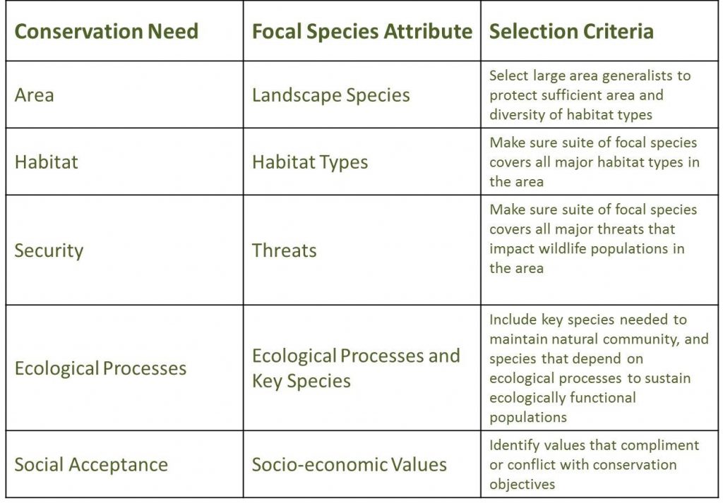
The table below provides the selection criteria for target species with different functional attributes that meet different conservation needs.
Selecting Landscape Species Suites
Landscape species are target species that “use large, ecologically diverse areas and often have significant impacts on the structure and function of natural systems” (Redford et al. 2003). Conservation planning for landscape species encompasses the needs of many other species and maintains functional landscapes that can support their needs.
This method of selecting suites of landscape species informs practitioners about where to focus conservation activities and how to perform them. We tend to choose landscape species based on five functional attributes:
 Area requirements
We know that wide-ranging species are particularly prone to local extinction, so meeting their needs will also provide for other species.
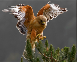 Heterogeneity of habitat
Some species use a variety of habitat types, and their conservation requires that each habitat type is present AND functionally connected. Meeting the habitat needs of these species ensures that we protect landscape CONFIGURATION as well.
 Sensitivity to stressors
Some species are subject to a great numbers of threats or are particularly sensitive to certain threats. Minimizing areas of certain land use activities or barriers can be important for these species.
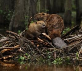 Ecological function
We also know that some species have critical functions in wild communities. Allowing them to continue fulfilling these ecological roles is obviously important.
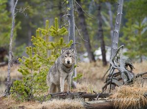 Socioeconomic significance
We know that the socioeconomic situation at a site can tip the playing field one way or the other, so we consider the economic value (both positive and negative) of the species, and whether it is a focal or flagship species, etc.
Spatial Considerations for Target Species
The specific habitat needs or sensitivities of target species will contribute to the spatial design of conservation areas. The table below illustrates how reserve geometry can be used to accommodate different types of target species.

Selecting landscape species targets in a conservation project
Often, selecting a suite of target species and conservation areas happens through community or stakeholder participation. For example, you might convene a workshop with local experts to systematically select multiple landscape species with a variety of functional attributes. Ahead of the workshop, you will want to gather several key resources to facilitate the discussion.
Workshop Preparation:
- Define the geographical boundary of the planning area
- Create a preliminary list of major habitat types in the area
- Generate a list of native species ranked by their habitat requirements
- Provide lists of major threats in the planning area, important ecological processes, and important socio-economic values
Species lists can be generated using tools such as the WildFinder Database (www.worldwildlife.org/pages/wildfinder-database) by the World Wildlife Fund (WWF). This tool can serve as a starting point for the species list.
Next, the species list should be sorted to categorize potential species targets by habitat and area needs, sensitivity to disturbances or threats, and their reliance on habitat connectivity.
For example, target species for a watershed in northern Michigan might include:
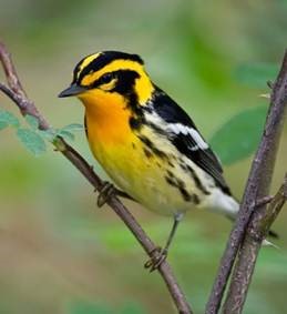 Blackburnian warbler
Interior forest, mature conifer, red and white pine, spruce, fir, hemlock, small home range
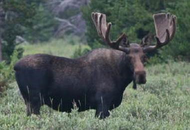 Moose
Moose
Conifer and young mixed forest, proximity to water, large home range
Methods for selecting targets in a planning project
If you are working in a community-based or collaborative process, your agenda tasks may include:
- Review the species list
- Review major habitats
- List threats – that meet the following criteria: occur within the project area boundary, are significant enough to jeopardize the persistence of native species with the area or the population size of multiple species or single keystone species, and can be mitigated
- Make initial species selection – by choosing a cohort of species with the highest area requirement categories, then select species from the first cohort that are most sensitive to threats, then compile a list of habitats that fall under the species umbrella. The list may be partial.
- Build the species suite – starting with the previous cohort of candidates, discard all species with land area requirements equal to or larger than those of the species chosen in the previous step. Add species from the next highest area requirement categories until the minimum cohort size is reached. Repeat until all habitats are provided full coverage under the suite and no additional habitat types are covered by remaining species.
- Complete umbrellas for habitat and threats – Add species to represent remaining habitat types or threats as necessary
- Evaluate gaps and include special elements as needed.
Defining Habitat and asking spatial questions
Defining Habitat
In landscape ecology and conservation planning, we use a specific vocabulary to describe the relationships of species to the landscape and the spatial patterns of those relationships:
- Habitat – sites with appropriate biotic and abiotic features required by a given species. Some species may require different types of habitat for different activities, such as feeding, nesting, or migrating.
- Patch – a contiguous region of the same habitat
- Connected – habitat occurring as few large patches, arranged in close proximity for dispersal, or within a hospitable matrix or buffer for crossing
- Fragmented – habitat occurring as many small, disconnected patches
- Interior/core area – part of habitat patches not influenced by edge effects
- Edge/edge effects – the boundary between two habitat types/changes in ecological factors near patch boundaries.
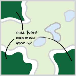
Landscape metrics illustrations by G.Martius, CC BY-NC-SA 4.0
 You can begin to see how this relates back to landscape metrics!
Let’s look at the definitions of habitat more closely.
Hall and colleagues (1997) defined habitat as “the resources and conditions present in an area that produce occupancy–including survival and reproduction–by a given organism” and emphasized that habitat “implies more than vegetation or vegetation structure.” We further define habitat as spatially and temporally explicit, with multiple attributes that can be modeled, mapped, and related to patterns of species occupancy across large extents.
Areas in a landscape are typically assumed to be ‘suitable‘ or ‘unsuitable‘ for a particular species. The reality is often more complicated. Habitat quantity, configuration, and quality vary in space and time. Some species require resources from different habitat types. And suitability based on land cover alone is often insufficient to capture and therefore conserve all of the areas necessary to the survival of a species.
The concept of habitat can sometimes be extended to multiple species occupying a given location, as we explored in Topic 1. Because few species exhibit the same response to abiotic and biotic features and processes, habitat is often described as species-specific. Planning for the conservation of multiple species requires evaluation of each species’ habitat and attributes of habitat shared among species.
Habitat quality is an extension of the habitat concept. Usually, higher quality habitat equates with higher frequency of use (or greater probability of occupancy) by an animal species.
Habitat-based Conservation Approach
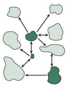 In the last topic, we learned about a species-based conservation approach. Another alternative for strategic conservation planning is a habitat-based conservation approach. Here, the abundance and arrangement of habitat is the focus, rather than demography of one or more species.
Habitat-based approaches are focused on identifying suitable habitat for key species, implying potential rather than actual current use by those species. Think of this as a ‘conserve it and they will come’ approach. Later, in the next module, we will learn about arranging habitat on the landscape through Habitat Cores, Connectivity, and Reserve Design.
It is important to remember that the same landscape may be very different for different species. So while this approach focuses on conserving habitat, an organism centered view is still needed. Also, this approach should recognize that patches of the same habitat type may vary in quality.
Efforts to Model and Map Habitat
The habitat-based conservation approach often relies on wildlife habitat models to identify or project the habitat or occupancy of target species in a given landscape. Many wildlife habitat models have been developed on the basis of expert knowledge, often augmented by published literature, or on the basis of statistical models and empirical data on animal locations. Habitat models rely on accurate knowledge of habitat use by animals that are often difficult to observe.
Expert-based models of habitat quality may be the only option in areas where empirical data is sparse or nonexistent. In this approach, one or more experts rank the relative habitat quality of all land-cover classes for the species in question, and these values are visualized on the landscape. The accuracy of this approach depends on the accuracy of the land-cover classification and other model inputs, and the relationship between actual animal associations with land cover classes and the estimates of experts.
Statistical models are the fundamental inferential tools used to estimate quantitative relationships between animals and their habitat. All model types have assumptions or limitations that will affect which model might be most useful for a given application.
Data Collection and Integration for Habitat Assessment
Data on animal locations or movement can be overlaid with other biophysical spatial data to map and quantify areas for reproduction, foraging, and dispersal.
Spatial representations of habitat quality can be:
- binary – where locations are classified as either habitat or not-habitat, there is no gradient
- categorical or continuous – where different features are assumed to represent different dimensions of habitat or habitat quality, as in a reclass.
Models of occupancy or habitat quality should be validated externally when possible (tested against field data that was not used as an input to the model) and cautiously interpreted.
Characterization of Habitat Quality
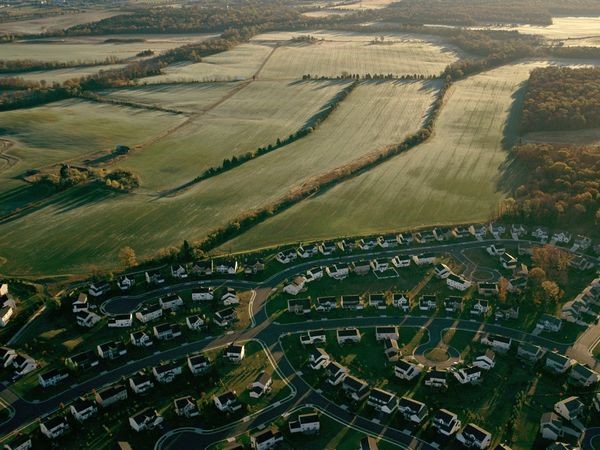 Characterization of habitat quality is usually based on a statistical model that relates empirical data on the distribution or population dynamics of a species to different landscape characteristics, including topography, land cover, and land use.
For example, recently developed empirical, statistical, remote sensing, and GIS-based methods can be used to model and map probability of occupancy, which often is positively correlated with, or assumed to serve as a surrogate measure of, habitat quality for many species of animals. These methods can be used to inform management for species and their habitats across multiple spatial and temporal extents and resolutions and in rapidly changing landscapes. Complex landscapes with areas of different types of land cover and land use, as shown on the right, provide a gradient of habitat quality for multiple species.
Wolf Habitat Example
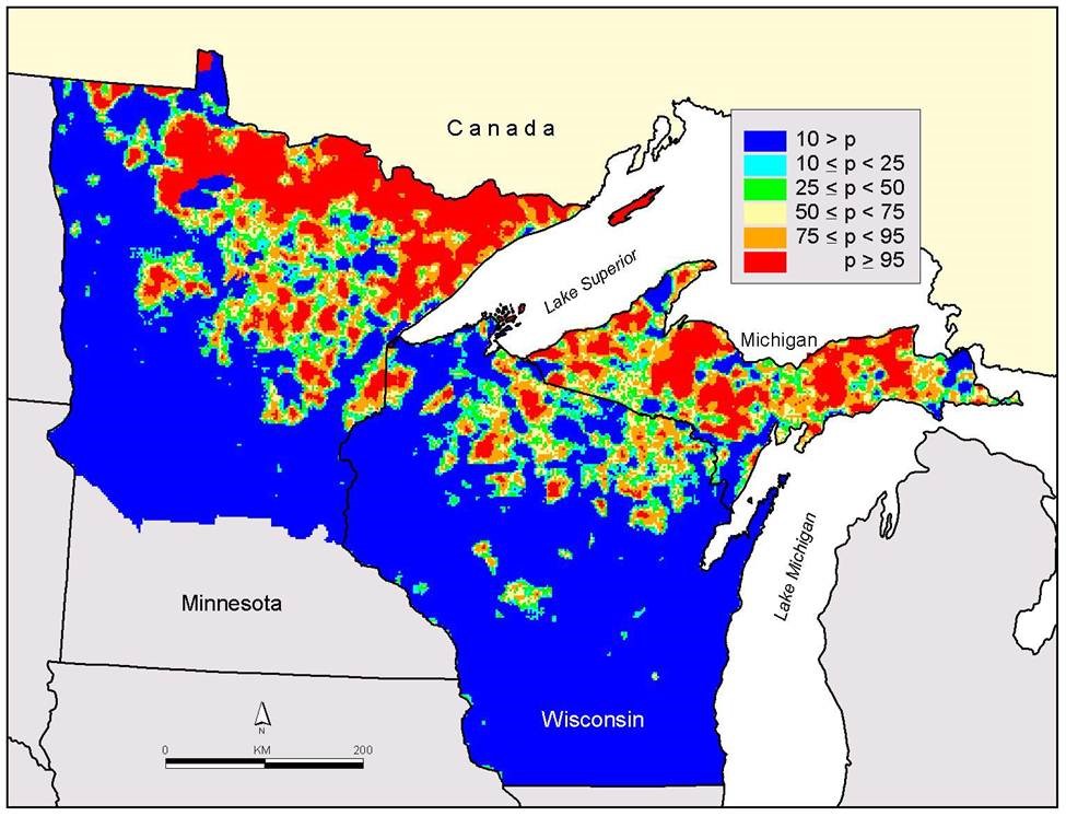
For example, wolf habitat is influenced by a number of factors including vegetation type, deer density, land ownership, road density, and human population density. The figure below shows wolf habitat as a probability of the number of individuals that particular areas in the Upper Great Lakes Region could support, as determined by the modeled influence of the factors above.
Habitat Based Conservation Planning Using ArcGIS
Here, we will provide an example of how landscape modeling can be used to compare potential impacts of landscape conservation strategies on habitat suitability for multiple wildlife species.
Research Questions

To understand the impacts of different management strategies on wildlife, this project sought to answer the following questions:
- How would different conservation strategies impact the amount and configuration of available habitat for selected target species 100 years into the future?
- Landscape metrics relevant to answering this question are total area of habitat, average patch size, and average nearest neighbor distance.
- Is there an “optimal” forest management scenario considering all species and criteria?
- Which species are more sensitive to alternative strategies?
Meet the Targets
A suite of landscape species was chosen with help from local experts. As described in Topic 1, species were chosen as surrogates for particular habitat types and requirements, including:
- different cover types
- old vs young forest
- edge vs interior
- open vs closed canopy
- disturbance sensitivity
- proximity to water
- small vs large homerange
- habitat specialist vs generalist
- species of special concern
Mammals such as moose and fisher, as well as turtles and fish were considered. In the end, the group arrived at five target bird species to best represent landscape conditions in this study.
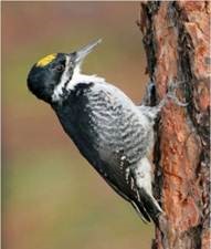 Black-backed woodpecker
Mature conifer habitat
Sensitive to disturbance
 Blackburnian warbler
Interior forest
Mature conifer, red and white pine, spruce, fir, and hemlock habitat
Small home range
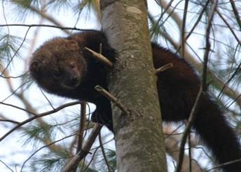 Fisher
Dense cover of mixed forests habitat
Coarse woody debris
Relatively large home range
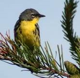 Kirtland’s warbler
5-20 year jack pine habitat
 Moose
Moose
Conifer and young mixed forest habitat
Proximity to water
Large home range
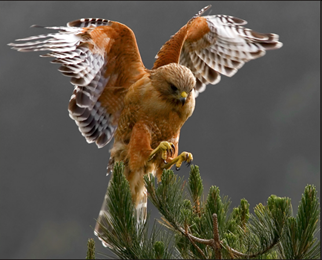 Red-shouldered hawk
Matrix and mature deciduous habitat
Proximity to water and openings
Large home range
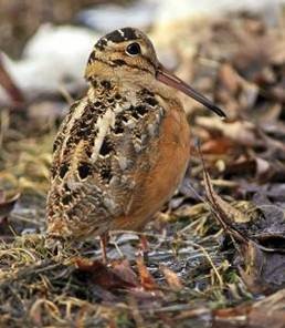 American woodcock
Early deciduous forest habitat
Proximity to openings
Small home range
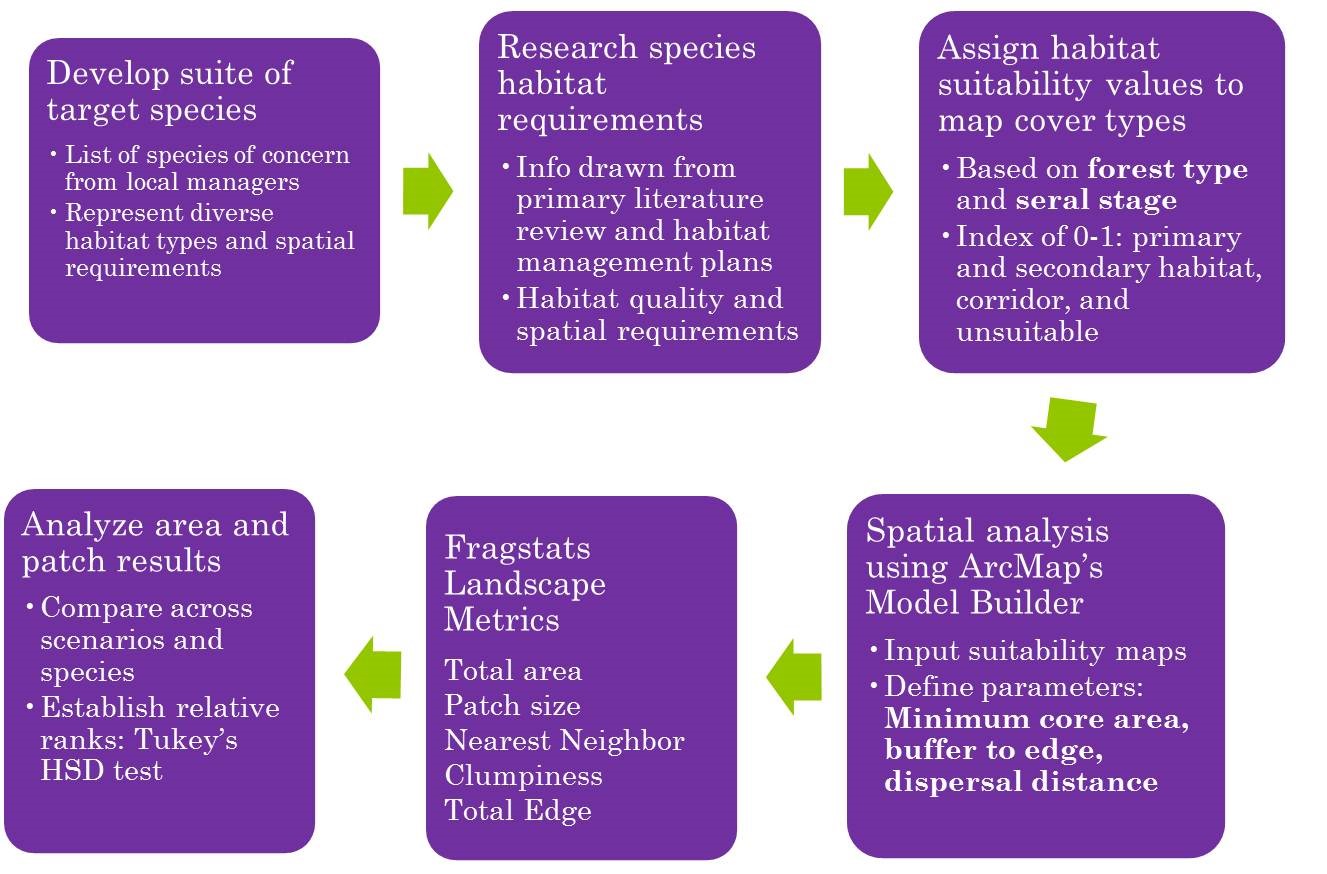
Habitat Assessment Process
The flow chart below shows the process for selecting a suite of target species and identifying suitable habitat for each under scenarios of possible future land cover.
Research Habitat Needs and Assign Habitat Suitability Ranks
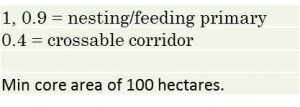
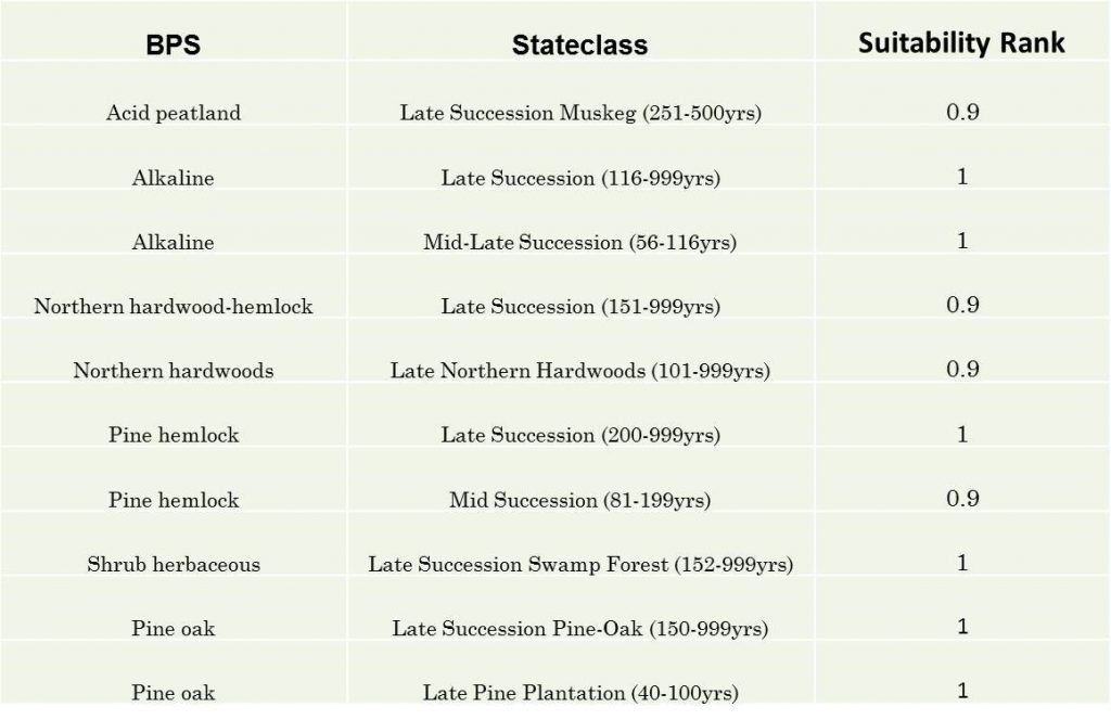
For each target species, land cover in the study area was ranked on an index of 0-1 based on suitability for the species as primary and secondary habitat, crossable corridor, and unsuitable habitat. The example below shows the habitat suitability index and rankings for the black-backed woodpecker. In this study, landcover was represented by ‘BPS’ (biophysical setting) and ‘Stateclass’ (successional stage).
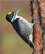 Habitat Suitability Index
Suitability Ranking for Each Cover Type (BPS)
Spatial Analysis Using ArcMap ModelBuilder
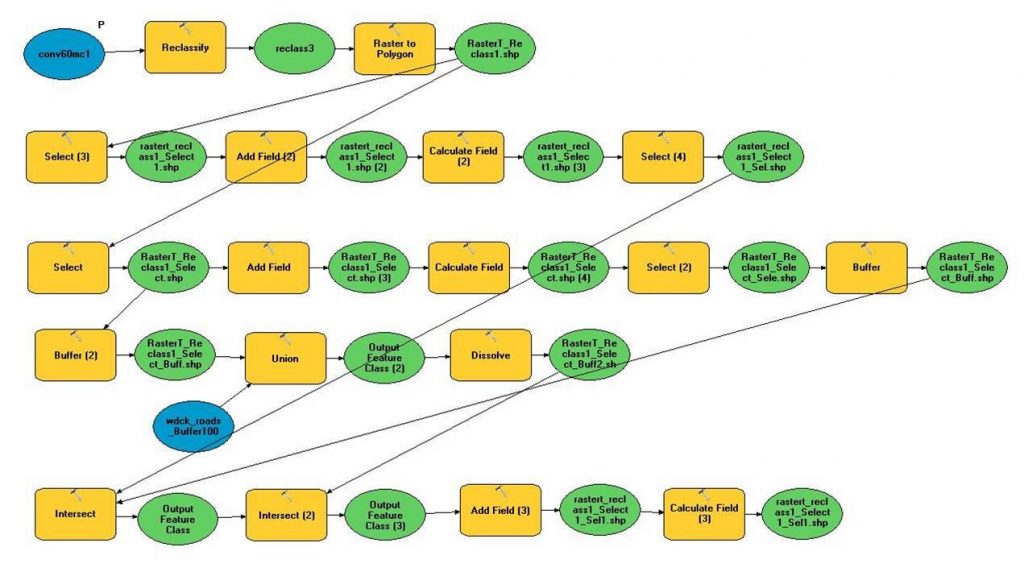
Next, the conservation scientist created a series of ArcMap ModelBuilder models to identify suitable habitat for each target species (woodcock shown here). This is a fairly complex ModelBuilder process, so given different habitat needs for each species, a different model was built for each.
Landscape reclassification
The landscape analysis process shown in the previous slide reclassifies the original land cover maps (top) to habitat suitability maps (bottom) identifying primary and secondary habitat, crossable corridor, and unsuitable habitat for each species.
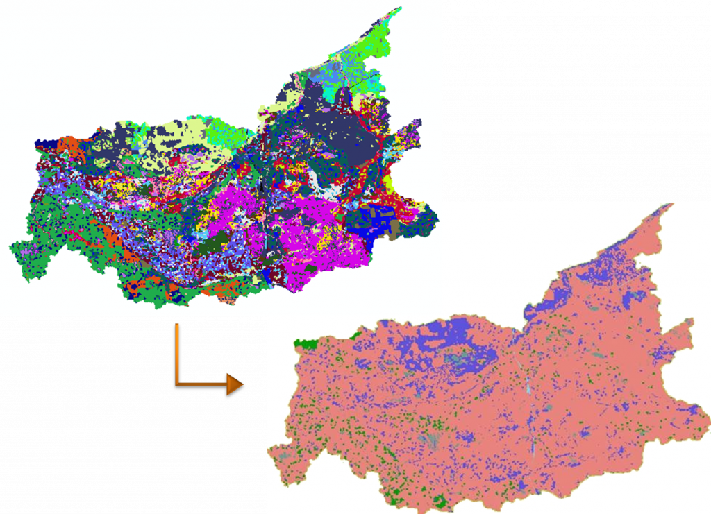
Habitat Suitability Maps
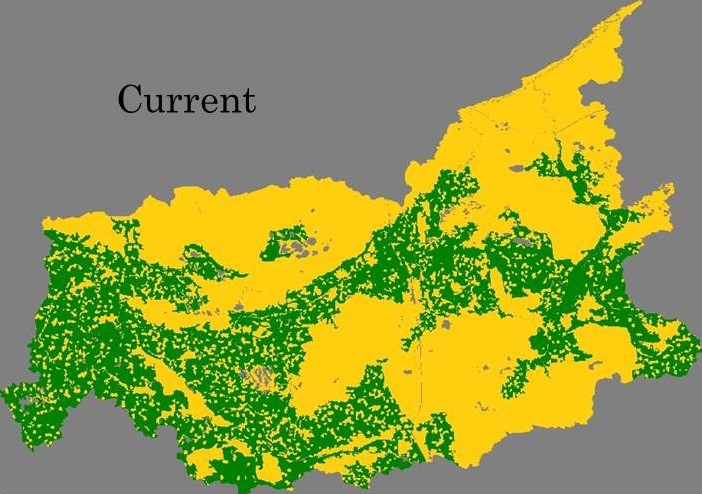
The maps below show suitable primary habitat (green) and crossable corridor (orange) for the black-backed woodpecker 100 years into the future if current forest management is continued.
Determining the Optimal Scenario
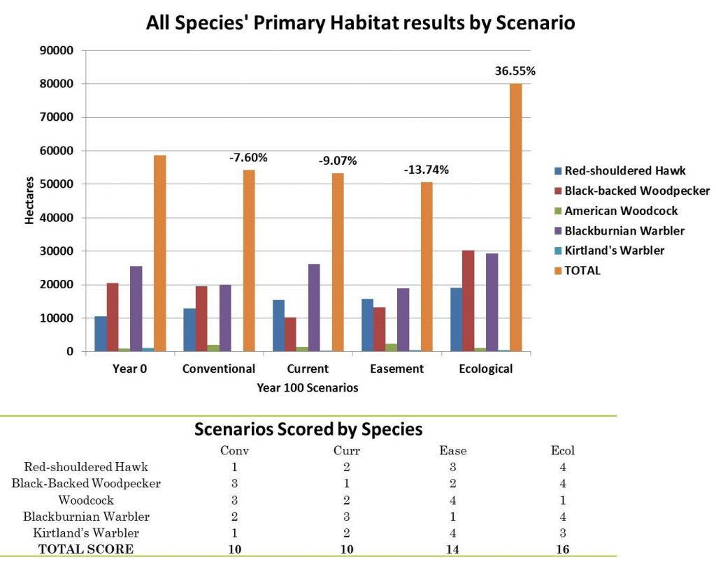
Habitat suitability analysis was performed for all five target species under four forest management scenarios. The chart below shows the change in the area of primary habitat for each target species under each scenario.
For each species, scenarios were scored from 1 to 4, with the scenario preserving the most habitat receiving a score of 4 and the scenario preserving the least receiving a score of 1. The species scores were totaled for each scenario, and the highest scoring scenario was considered optimal for the greatest number of species. As you can see, scenario landscape modeling, GIS, and landscape indices can help identify the tradeoffs between scenarios to inform habitat-based conservation.
See Nixon et al. 2014 in Journal for Nature Conservation for the full results of this study.
References
Nixon, K. J.Silbernagel, J.Price, N.Miller, and R.Swaty. 2014. Habitat availability for multiple avian species under modeled alternative conservation strategies for the Two Hearted River Watershed in Michigan’s Upper Peninsula, USA. Journal of Nature Conservation, 22(4) August:302-317, doi:10.1016/j.jnc.2014.02.005
