
2 The Study of Place
Jimmy Taitano Camacho
The ‘study of place’ is a dynamic method of inquiry and process that ascribes meaning to place. Since the 1970s, scholars have reconceptualized its importance, emphasizing how the study of place may reveal new and potentially ’emancipatory’ understandings of the world.[1] Edited volumes, entire books and numerous journals present an assortment of methodologies and methods, to study place. Collectively, this expansive body of literature reflects the many processes that may be employed to study place.
The term ‘place’ is in and of itself a dynamic concept. It is most commonly depicted by spatial boundaries, lines that delineate political entities and geographic features. References made to the nation, the state, the city, the border are all common ‘places’ invoked in everyday discussions. However, the lines imposed to delineate place inhibit the many different angles through which ‘place’ may be conceptualized.
For example, the timeline created by Kendra Greendeer in the following chapter retraces moments in time to uncover when the region (what is now North Dakota) was first inhabited. By examining historical and archival data, Greendeer illustrates that the Native Mandan people traveled to this place more than 2,000 years ago—they referred to it as the “Heart of the World.” Moreover, Carly Griffith examines how national reliance on energy derived from the region may transform the landscape and the heritage of people that have sustained themselves in Stark County, for generations. Both projects show how a ‘place’ may be transformed by considering different moments in time (i.e. 2,000 years ago) and phenomenons (i.e. national reliance on oil) that transcend political boundaries.
Place is also a common practice through which we engage with one another and the (physical and natural) world around us. Planning organizations, for example, often describe a place by referring to statistics and government policies (e.g. zoning codes) to inform public decision making processes. Stories told of where someone grew up, establish a link between the present and the past, in relation to places—whether it is a home or a neighborhood. Furthermore, we often discuss place in everyday discussions, regarding events that occurred, the climate of a particular region, like winters in the Midwest, and we frequently travel to different places daily, such as work, the grocery store, or school.
Thus, place may be depicted in multiple ways. This paper illustrates one unique approach to document and develop a ‘sense of place.’ Our objective as graduate students was to examine farmsteads constructed by European immigrant groups in Stark County during the first decade of the twentieth century. The following section provides a broad overview of the process and the methods employed to document this place. I conclude by reflecting on the approach, and consider how this work is valuable, despite the limitations of time and being mere ‘outsiders’.
The Field School
Process
Preliminary research for this project considered existing data and publications, such as the Folk Farmsteads on the Frontier report prepared in 2017[2]. Additionally, other sources were reviewed to develop research questions and identify how we could further develop a sense of place.
To facilitate this endeavor, we approached this project through an interdisciplinary and collaborative process, whereby each student, drawing from our individual disciplines, experiences and skills, collected data through measured drawings, photography and interviews. The following section provides a brief overview of these methods and how they inform this the study of place.
Methods
Thomas Carter describes the process of drawing as a “rigorous investigative process that employs/utilizes all available methods and technologies to generate accurate and verifiable information.”[3] Drawings include detailed measurements of structures, as well as distinguishable architectural features (e.g. the vorhausl at the Stephan Boehm Farm), and the positioning of structures within the broader landscape. The primary data—measurements—is refined, replicated through software or a series of standardized drawings, and then it may be presented through site plans, elevations and floor plans. These drawings enable the analyses of space and how it, for example, facilitates movement, household activities, and reflects the divisions of labor (see Chapter by Ahmed Abdelazim).
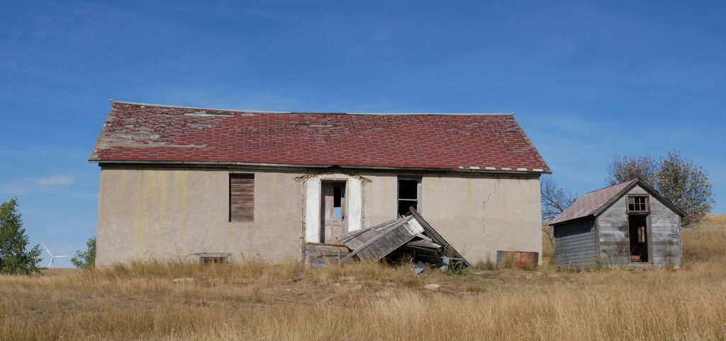
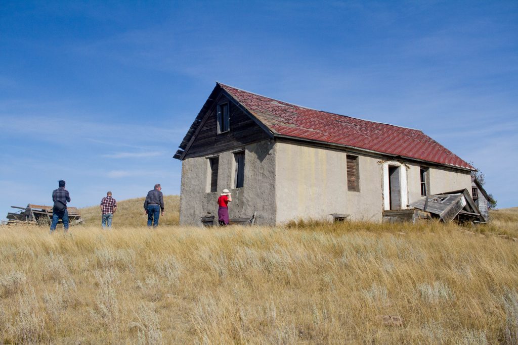
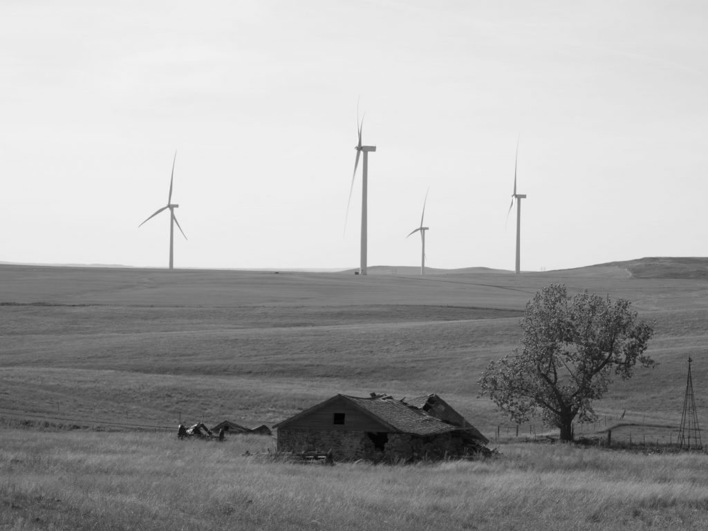
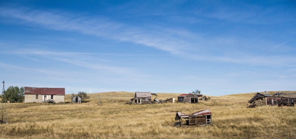
Photography
Photographs also document the features of buildings and their relative location within the landscape. They preserve visual information, enable memory recall, and contextualize measured drawings.[4] For this project, photographs were particularly useful for documenting distinct features, such as the location of the buildings at the Stephan Boehm Farm and their relative position to the wind turbines on the horizon. The compilation of these features in the photograph illustrate the limitations of measured drawings, and it demonstrates how photographs enable an audience that would not otherwise see this place, to reflect on what the landscape was like prior and what the people who constructed this place would think of the change.
Interviews
Maori scholar Alice Te Punge Somerville describes interviews as archives, oral stories that “are full of interactions, messages, connections” and documented for others to recall and reflect upon[5] These archives are capable of sustaining the histories of individuals and communities that may otherwise be lost or obscured as time passes and change occurs. Documenting the stories of people that constructed farmsteads in North Dakota, for example, reveals in very specific terms how people adapted to the windswept landscape and the change occurring as a result of cyclical energy booms (see Chapter by Carly Griffith).
_____
Reflecting on the Field School
Approaching the study of place through a field school affords a unique approach to study place. It is nearly impossible, I imagine, to replicate the experience of being in the field—seeing the landscape, physically touching materials used to construct homes built more than one hundred years ago, and learning the stories of others through face-to-face dialogue— all of these experiences afforded through the field school shape how we see and present this place here, in distinct ways.
In theory, each one of the authors included as part of this e-book examined identical data sources. Yet, we individually made decisions, drawing from our academic and personal backgrounds to develop a sense of place. My colleagues show here how the data derived from a field school approach may be presented through a multitude of ways, such as maps and sculptures (see Chapters by Travis Olson and Matthew Vivirito).
Each contribution further develops a sense of place and illustrates the many ways place may be depicted. Given the limits of time in the field, this project nevertheless remains incomplete. It culminated in an archive, a collection of stories that provides a more expansive but still incomplete narration of North Dakota, Stark County and the “Heart of the World.” It will remain incomplete and open to further inquiries. As time proceeds and economic, political, national and global forces accelerate change, this approach provides a unique opportunity to document place and the people that shaped and are shaped by the many different elements that constitute this ‘place’.
- Edward W. Soja, Postmodern Geographies: The Reassertion of Space in Critical Social Theory (New York: Verso, 1989). ↵
- https://wisc.pb.unizin.org/ndfieldschool2017/ ↵
- Thomas Carter, “Taking Measure: The Need for Standards in Vernacular Architecture Field Documentation,” Vernacular Architecture Newsletter 109 (Fall 2006): 1, 3-7. ↵
- Carter, "Taking Measure." ↵
- Alice Te Punge Sommerville, "I Still Have A Letter:" Our Sea of Archives,” in Sources and Methods in Indigenous Studies, ed. Chris Andersen and Jean M. O'Brien (New York: Routledge, 2017), 123. ↵